
Google Maps, since its launch, has been an essential tool for navigation and geographical exploration. However, over the years, the application has participated in various controversy that raised discussions on accuracy, ethics and responsibility.
Here are some of the most notable controversies involved in Google Maps.
Gulf of Mexico and more: 7 controversies over Google Maps
Gulf of Mexico, renamed “Gulf of America” (2025)
In January 2025, Google announced that the Gulf of Mexico would be renamed “Gulf of America” for US users. The change was based on a US government resolution, led by the then President Donald Trump, who justified the change as an economic and political measure in relation to Mexico.
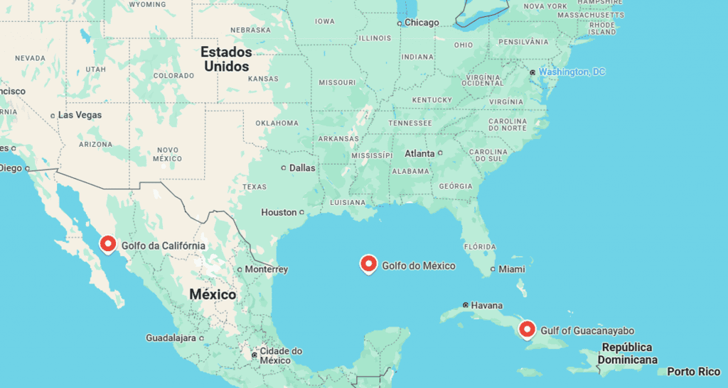
The decision led to international criticism, and many accused Google of giving up political pressures. The application said that it would only follow official sources for geographical updates, but the controversy raised questions about the platform’s neutrality.
Died from bad directions (2020-2024)
Navigation errors have already resulted in tragedies. By 2020, a driver in Russia died frozen after following a suggested route by Google Maps that took him to an abandoned road.
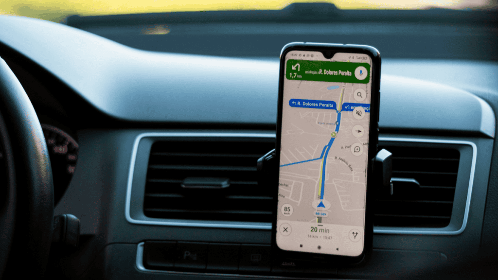
In 2024, three men from India died falling from a bridge under construction after they followed an incorrect path that indicated the application.
Tracking NSA users (2014)
The documents filtered by Edward Snowden in 2014 revealed that the United States National Security Agency (NSA) and the GCHQ (British Intelligence Service and espionage) intercepted consultations with Google Maps made of smartphones to keep track of users.
A 2008 document stated that “Anyone using Google Maps on a smartphone supports a gchq system“The revelation has aroused concerns about the privacy and security of user data.
Delimitation errors of borders (2010)
In October 2010, the military commander of Nicaraguan Edén Pastora used Google Maps to justify the occupation of Isla Calero in the Delta of the Sant Joan River. The application mistakenly showed the area as part of the Nicaragüa, giving rise to a territorial dispute with Costa Rica.
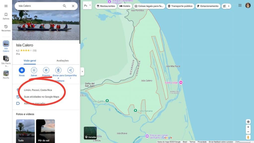
Google acknowledged the error and updated the data, but the incident highlighted the risks of blindly relying on digital platforms for geopolitical problems.
Incorrect Sites (2010-2024)
Google Maps has already been criticized for adding obsolete or incorrect neighborhood names to its platforms. In Los Angeles, for example, historical names such as “Brooklyn Heights” (from the 1870’s) and “Silver Lake Heights” (from the 1920’s) were resurrected, causing confusion between residents and companies. In Detroit, the “Fiskhorn” neighborhood was mistakenly received the term “fishkorn”.
These errors, often originating from non -professional users or map suggestions, were widely adopted by real estate agents, delivery services and even news places.
Read -Ne More:
Congestion simulation (2020)
In February 2020, artist Simon Weckert used 99 Google Maps enabled in a hand cart to simulate the virtual traffic jam. The application interpreted slow advance as intense traffic, changing street color and redirecting drivers

The experiment has shown how the platform can be manipulation, raising questions about the accuracy of real -time traffic information.
Favelas Smoke from Map (2013)
Google Maps eliminated the term “favela” to identify several communities of Rio de Janeiro after a request made by the City Council of Rio de Janeiro in 2009. Places like Favela Sumar I will and Favela Morro do Chacrinha changed their names. The change was noticeable in an update in 2013 and caused controversy on social media.
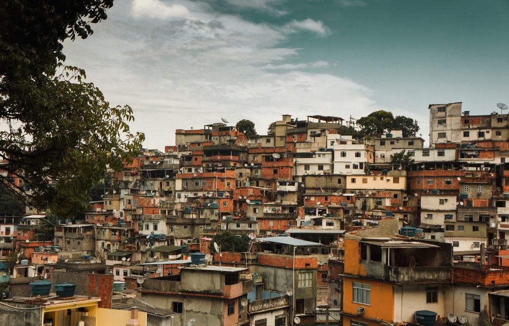
Some netizens supported the measure, arguing that it could reduce the stigma over the residents of these areas. Others criticized, claiming that the removal of the term could make it difficult to security and orientation in the city.